Air pressure is one factor that plays a role in the weather. The atoms and molecules in the atmosphere are constantly
moving around. When more molecules go to one area the number of strikes per unit of time and area also increases.
This air pressure can be exerted in all directions. The higher the elevation, the less air pressure there is.
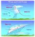
Warm air is far less dense than cold air.
The unit for air pressure is the Pascal (Pa), named after Blaise Pascal, has been used by Meteorologists since 1929.
One pascal equals .01 millibar. The two most common units are "Inches of Mercury" and "Millibars". The standard
air pressure is 29.92 in inches of Mercury and 1013.2 in millibars. Weather maps show the highest air pressure by the
blue H's and the lowest by the red L's.
When the barometer falls in hot weather it stands for thunder or high wind, in cold it means thaw, in wet weather expect
a lot more, and in fair expect a lot of rain and wind in a couple days. The barometer always falls the lowest for wind
and rain together.
When it rises in winter it means frost is coming, in frost it means snow, if fair happens right after it rises, expect
it to last for a short time. When it rises very high in wet weather, and remains, fair weather will come in a couple
days, but if it suddenly jumps the fair weather won't last very long. The barometer rises highest for north and east
winds.
When there is unsteady pressure expect unsteady weather. When it motions upwards there's good weather coming,
but if it lowers storms are approaching.
In general, high pressure is good and low pressure is bad.